Barlborough and Clowne
Barlborough and Clowne division forms part of the north west of Bolsover. It comprises the parishes of Barlborough, Clowne and the settlement of Stanfree, which is part of Old Bolsover parish. Barlborough and Clowne are urban whilst Stanfree is semi-rural. View the information page for councillor Natalie Hoy
This page contains links to key information and statistics for this Electoral Division. The links to the maps and profiles are specific to this division, but some of the links such as to the Quilt are to generic information.
If you have any questions regarding any of the information on this page then please send an email to research@derbyshire.gov.uk
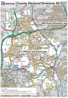
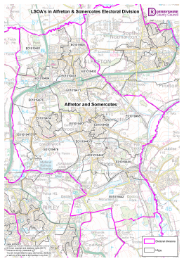
Electoral Division Maps
For detailed statistics and information on the following topics please click on the relevant link below
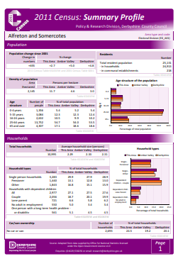
Population
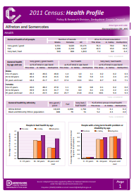
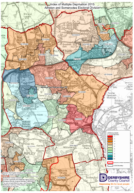
Deprivation
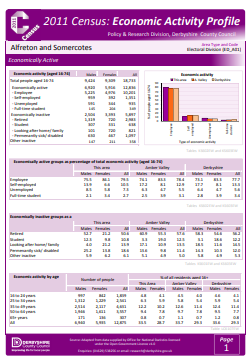
Unemployment
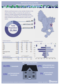
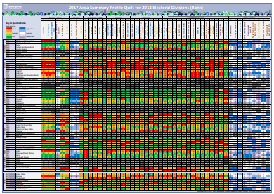
Area Profile, Quilt
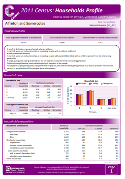
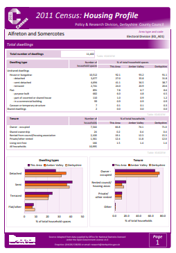
Census profiles