2021 Census First release statistics

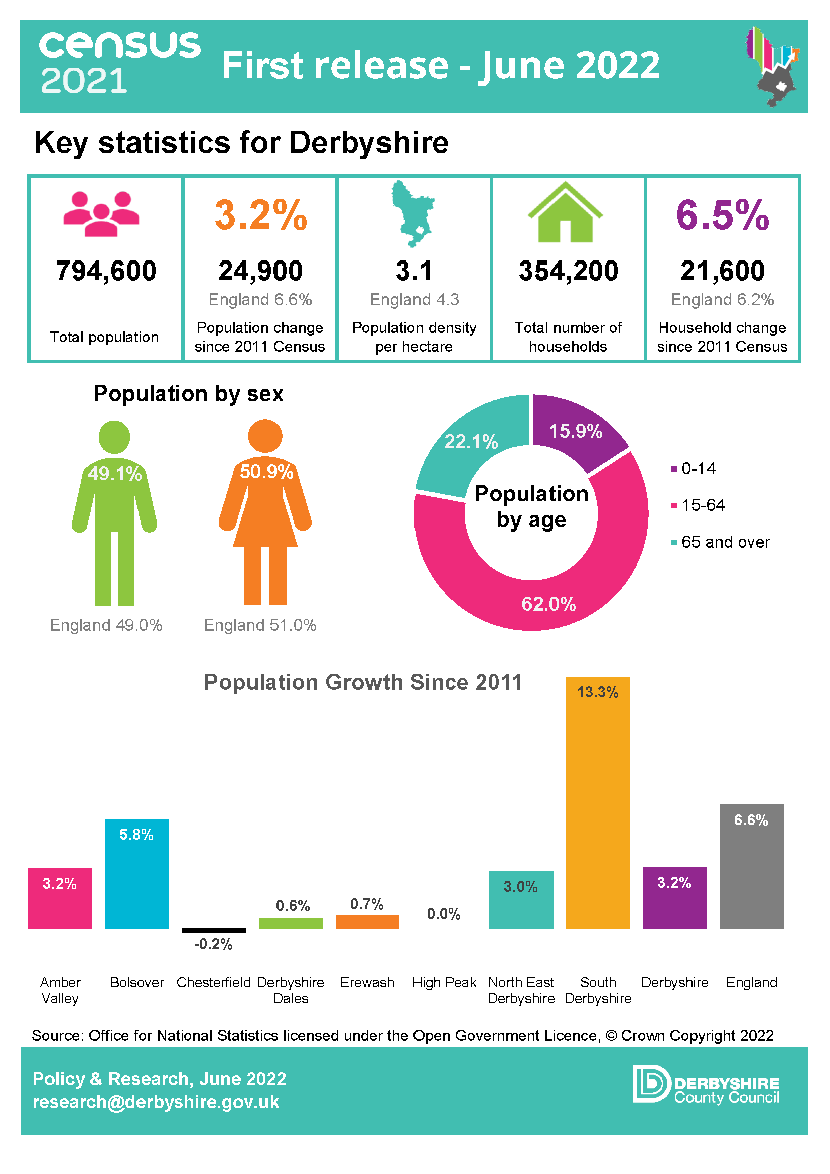
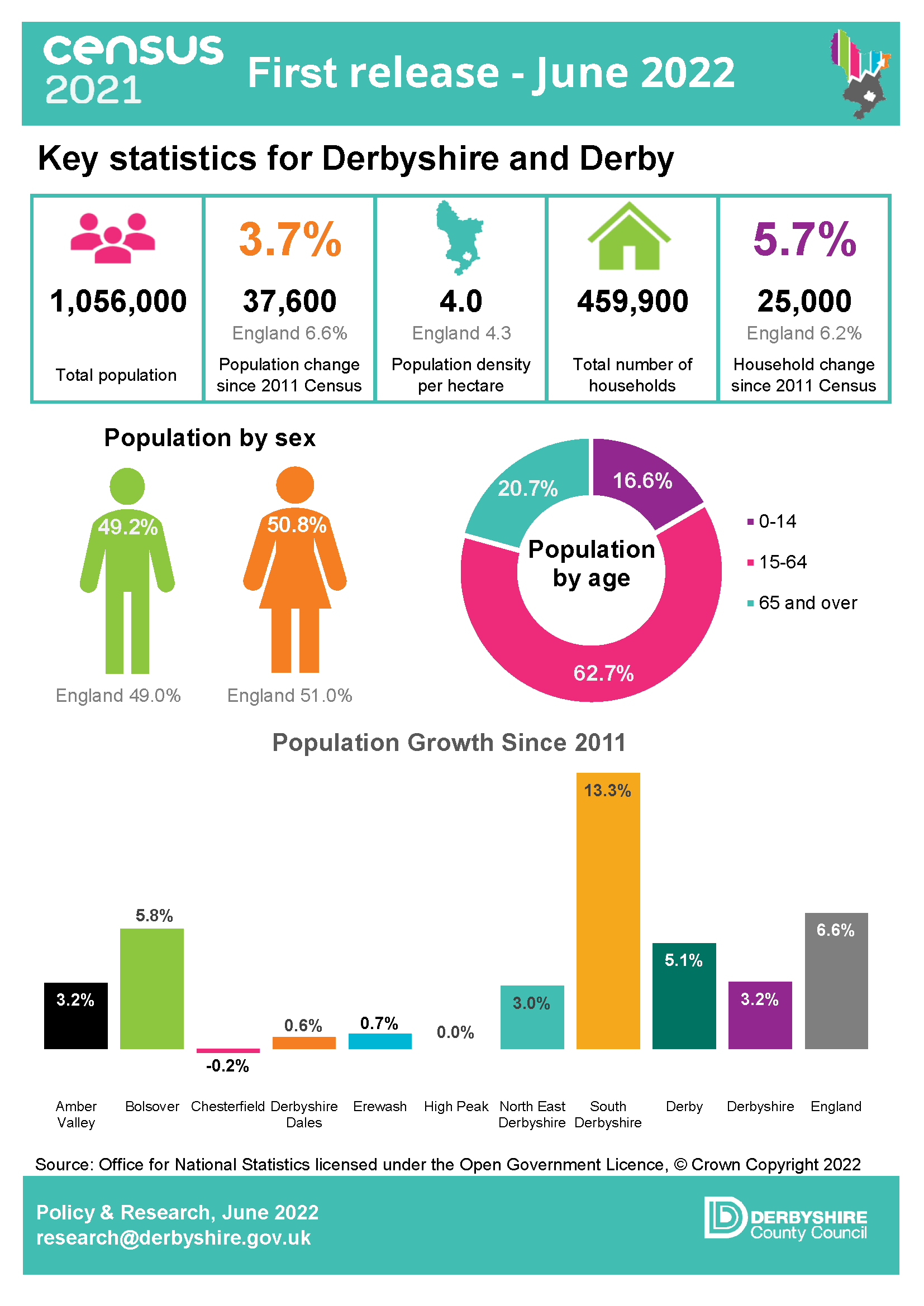
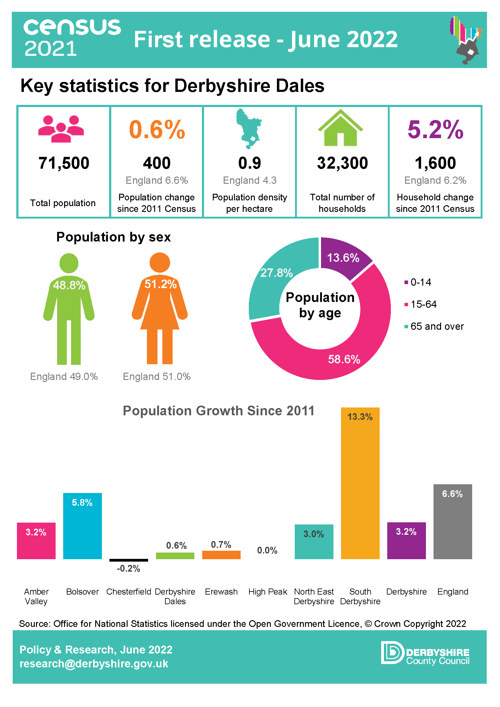
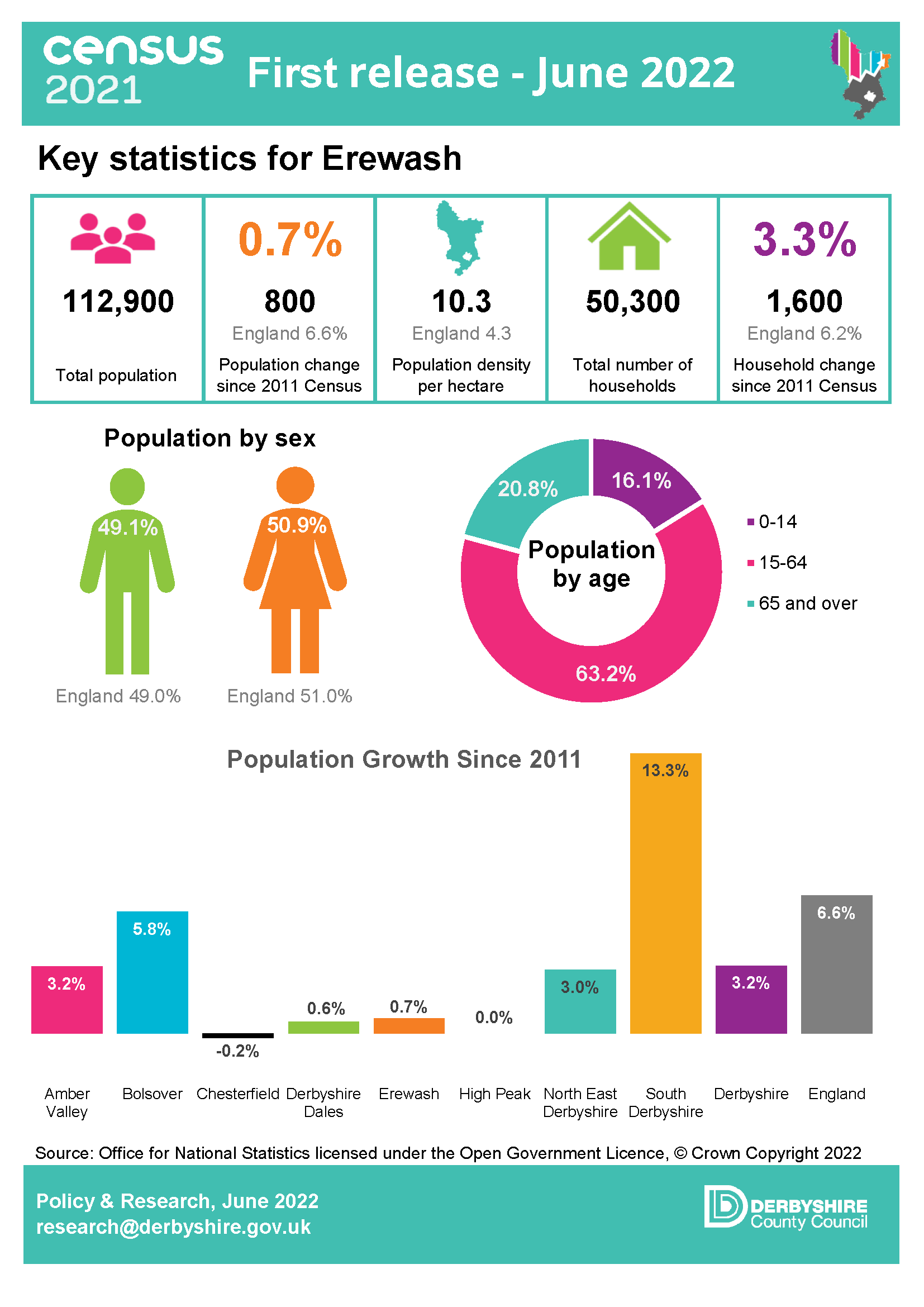
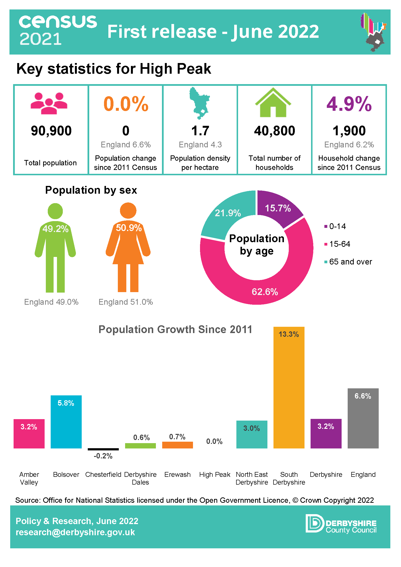
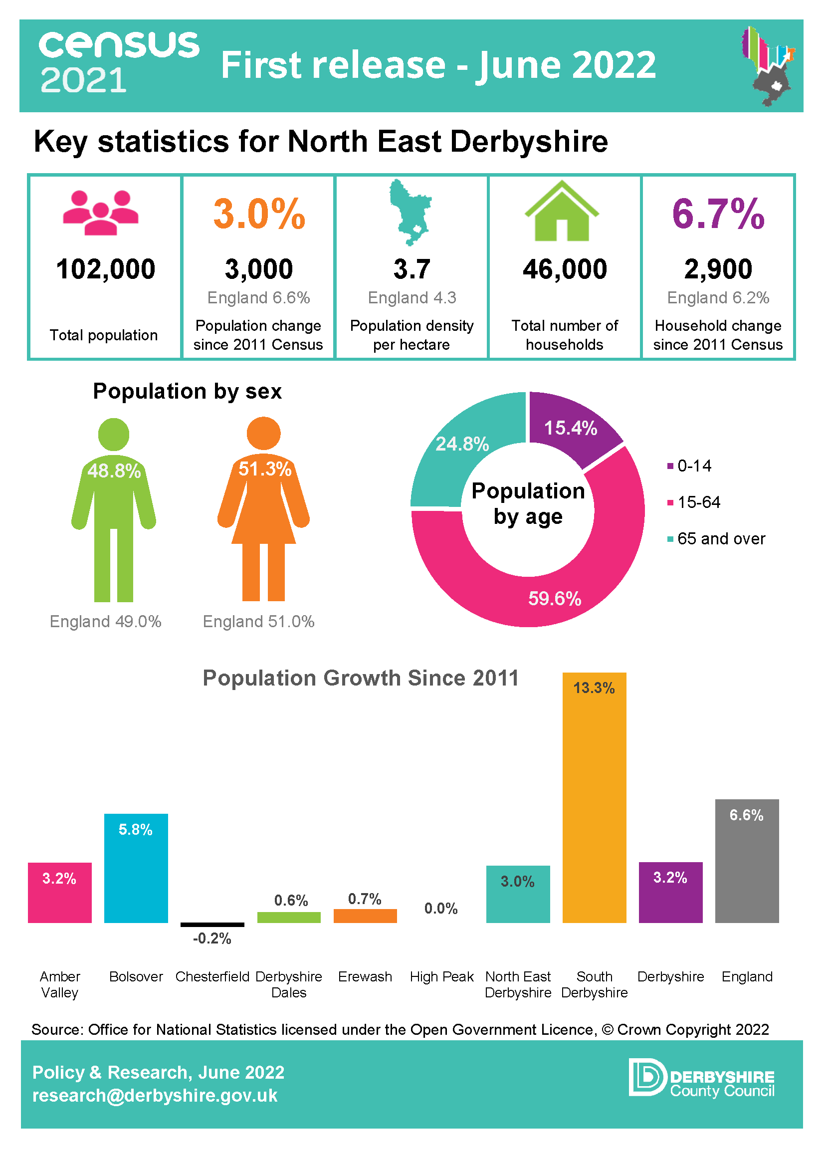
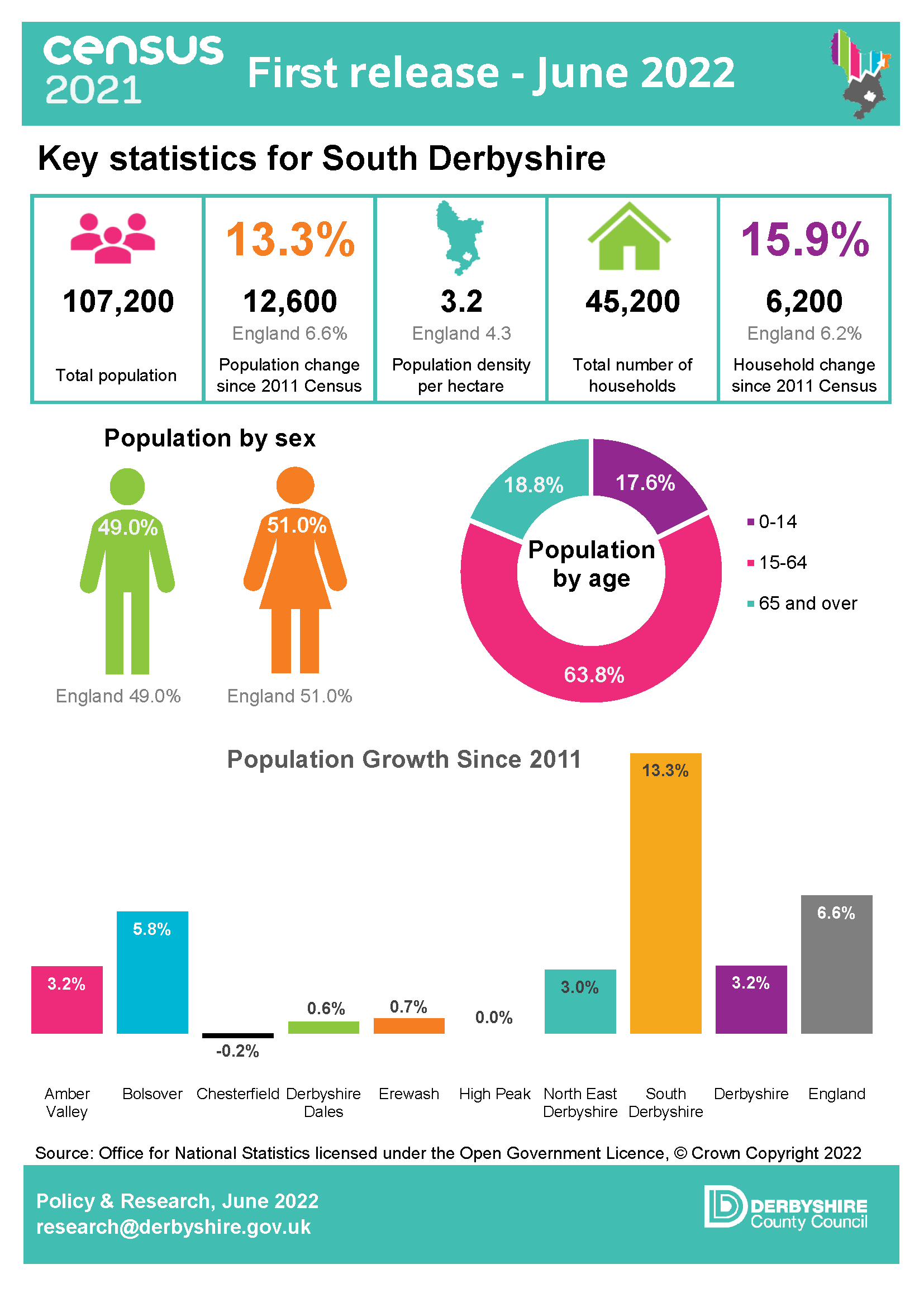
The first set of 2021 Census data was released on 28 June 2022. This included population data by gender, five-year age band and household estimates at local authority level and above. The key findings for Derbyshire can be found in the infographics and links below

How Derbyshire’s population has changed since 2011
Census 2021 – detailed population statistics for Derbyshire and districts

Derbyshire
Derbyshire
Derbyshire
Derbyshire and Derby
Amber Valley
Amber Valley
Bolsover
Bolsover
Chesterfield
Chesterfield
Derbyshire Dales
Derbyshire Dales
Erewash
Erewash
High Peak
High Peak
North East Derbyshire
Link to IMD map - Alfreton and Somercotes
South Derbyshire

Topic Summaries

From October 2022 the ONS published a series of data and supporting commentary by theme, known as topic summaries. To access key 2021 census statistics, maps and analysis for Derbyshire please select a topic below

Link to story map of population for Derbyshire
Population
Link to story map of households in Derbyshire
Households
Link to story map of population for Derbyshire
Cultural diversity
Link to story map of labour market for Derbyshire
Labour market
Link to story map of Health of Derbyshire's residents
Health
Link to story map of Gender identity and sexual orientation
Gender identity and Sexual orientation
Link to story map of Education
Education
Link to story map of Housing and heating
Housing

Census Summary Profiles

From early 2023 multivariate census data was published, allowing you to combine variables and explore relationships between the data on the usual resident population of England and Wales. A series of summary profiles covering key data topics for a range of geographies have been developed and can be accessed below

Links