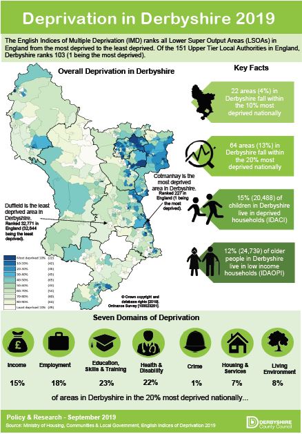
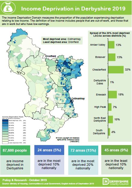
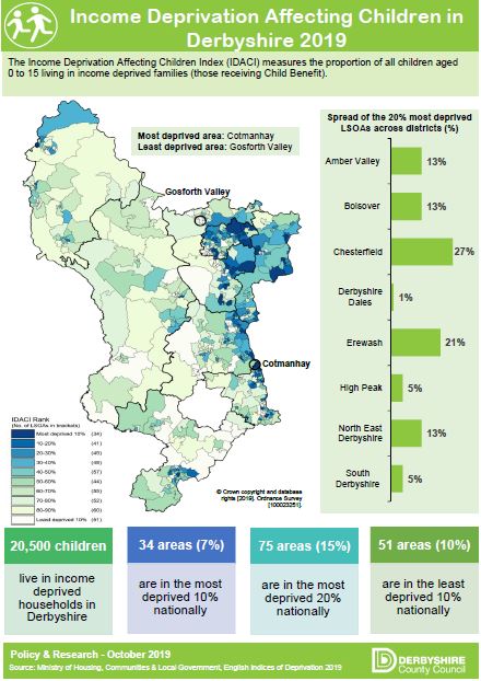
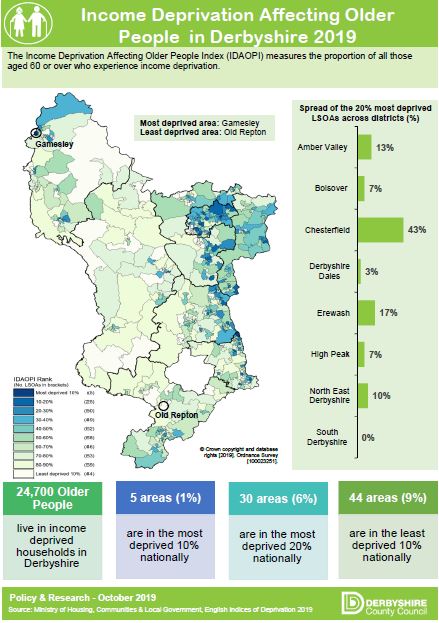
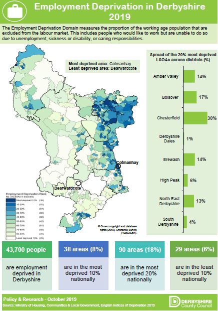
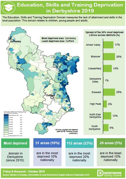
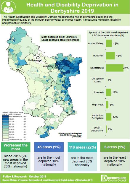
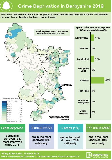
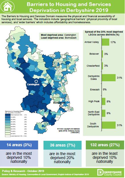
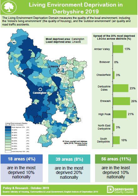
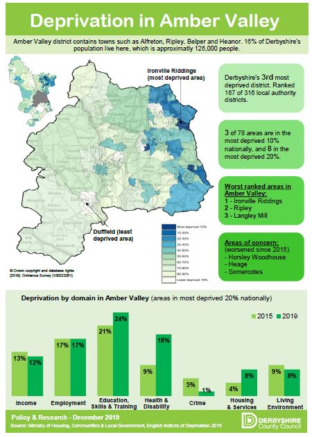
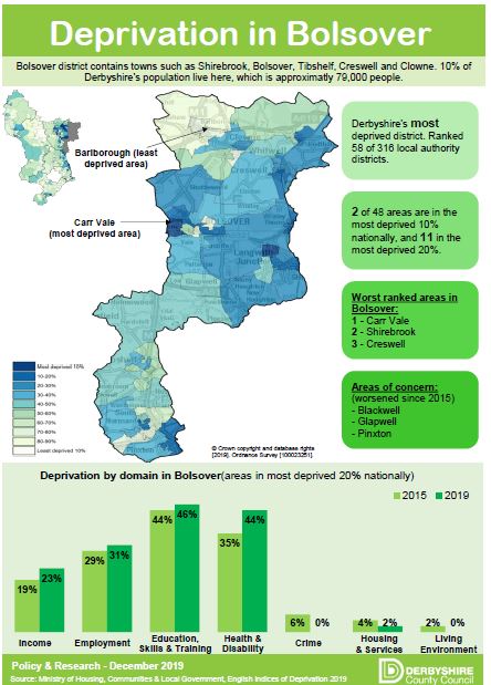
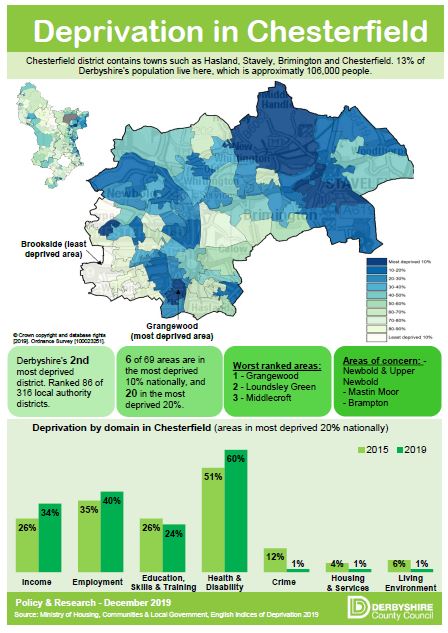
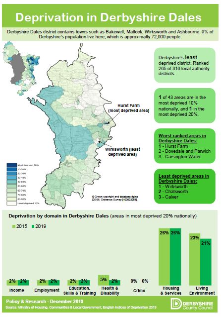
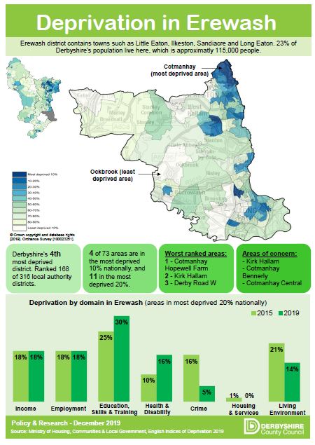
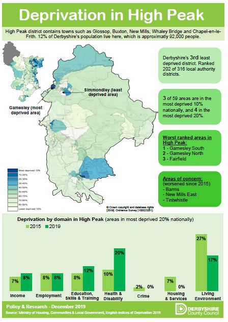
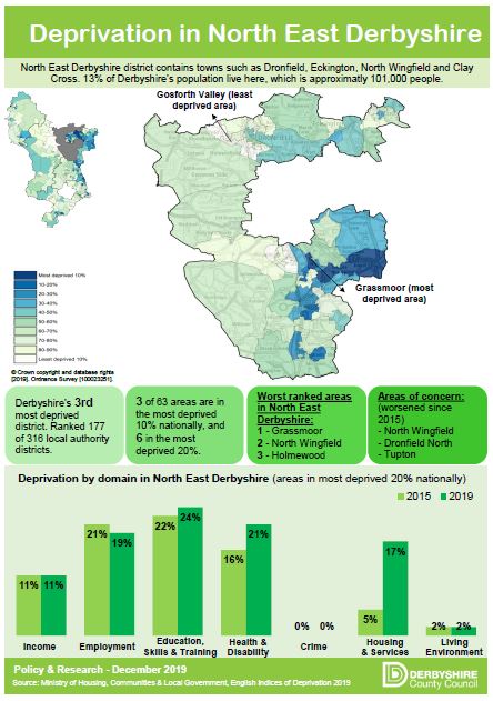
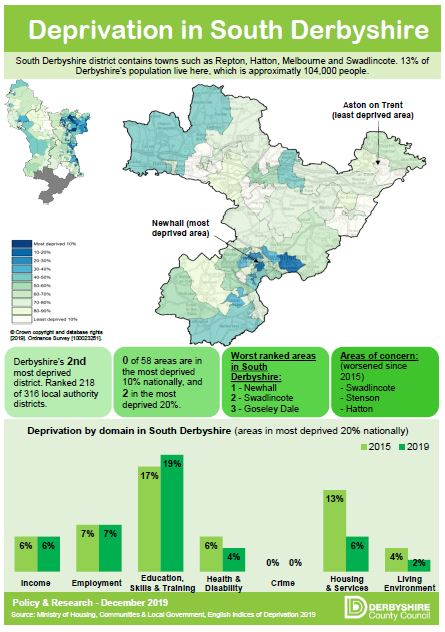
The rising cost of living including food and fuel means that some communities in Derbyshire experience higher than average levels of deprivation and poverty. The Index of Multiple Deprivation (IMD) is the most commonly used measure of deprivation and the 2019 index shows there are 22 out of 491 small areas in Derbyshire that fall within the most 10% deprived areas across England. Most of these areas are located in the North East of the county in the former coalfields areas.
Interactive Maps and Charts
- Index of Multiple Deprivation (2019) – Map
- Child Poverty – Map
- Fuel Poverty – Map
- Landlord & Mortgage possessions – Map
- Bankruptcy Orders, Debt Relief Orders, Individual Voluntary arrangements and Personal Insolvencies – Map
- Homelessness – Map
- Gross Disposable Household Income
Static Maps
- Map: 2019 IMD for Amber Valley
- Map: 2019 IMD for Bolsover
- Map: 2019 IMD for Chesterfield
- Map: 2019 IMD for Derbyshire Dales
- Map: 2019 IMD for Erewash
- Map: 2019 IMD for High Peak
- Map: 2019 IMD for North East Derbyshire
- Map: 2019 IMD for South Derbyshire
- Map: 2019 IMD for Derbyshire
Spreadsheets
Documents
Links
Headline Infographics
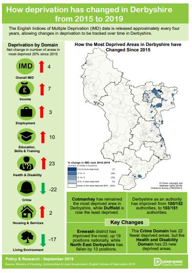
Deprivation in Derbyshire 2019 How has deprivation in Derbyshire changed between 2015 and 2019

