Glossop and Charlesworth
Glossop and Charlesworth is a two member division stretching across the north of High Peak. The division is comprises the wards of St John’s, Padfield, Dinting, Old Glossop, Howard Town, Whitfield and Simmondley. The main urban population is concentrated in the town of Glossop. To view the Councillors’ information page click on the councillors name Damien Greenhalgh, Jean Wharmby
This page contains links to key information and statistics for this Electoral Division. The links to the maps and profiles are specific to this division, but some of the links such as to the Quilt are to generic information.
If you have any questions regarding any of the information on this page then please send an email to research@derbyshire.gov.uk
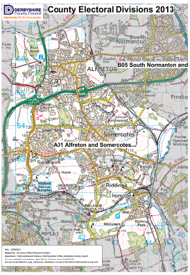
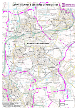
Electoral Division Maps
For detailed statistics and information on the following topics please click on the relevant link below
Population
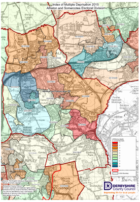
Deprivation
Unemployment
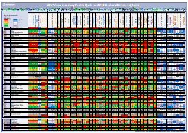
Area Profile, Quilt
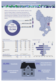
Census profiles